

Iceland felt like being in Middle Earth, Narnia, and on the Moon all at the same time. It's the home of epic landscapes and scenery that has been chosen to depict worlds in fantasy and science fiction. It's one of the geologically young places on Earth with rolling green fields, to black beaches made of rich volcanic sand, to snowy mountain peaks. It's the most beautiful place I've been to in my life.
My journey to Iceland began a few years ago, when I happened to search online for "the most stunning locations on Earth” to get ideas for place’s I wanted to see in my lifetime. I was blown away by some of the photos that I'd seen. The next two years after deciding Iceland would be my first destination, I was fortunate enough to have my schedule kept filling up with weddings and corporate work rolling in during the months I could normally take time off, but it meant my dream had to wait.
Early last fall I decided to limit what I took on during late August or early September to make sure I would have time to go. I picked this time of year because it's the one of the slower months for photo/video work for me, and is late enough in the summer where most of the busy tourist season traffic would have died down but not too late in the year where roads would be closed with snow and ice. Ever since I mentioned "I want to go to Iceland" about 2 years ago to one of my best friends, Bryant, he was completely sold on it.
My real planning started earlier this year when I started deciding what I could realistically do in 5 days due to the limited time I could take off. I set my priorities on locations around the Ring Road and scoured through hundreds of photos online using Google Maps as my guide for how long it would take to get from point A to point B to point C. During this time I thought of driving north to Akureryi and then double back towards the Western Fjords to see some of the more remote areas which are normally home to puffins and other birds native to the island. This plan changed when I found that I would need to take a long boat ride to some of the places I wanted to see in the north west which wouldn’t be the best use of my limited time there.
As I started looking around online about the island as whole I found a few locations that were stunningly beautiful and I began to think about doing what seemed impossible (from the research I had done): traverse the entire Ring Road in 4.5 days. I'd been reading blog post after blog post of other travelers who had traveled the Ring Road and everyone said "you really have to have at least 7 days, ideally 10 or more to do the Ring Road. I decided if I was only going to have the opportunity to go once in my life, sleep was something I wasn't concerned about. I began creating a detailed plan down to the hour (a skill I acquired from my mother’s planning habits on our family vacations growing up) to make sure I squeezed the best out of every waking moment there.
DAY ONE
Our flight out of DC had been delayed, not because of the impending volcanic eruption but rather because of high winds in Keflavik Airport (Iceland's primary international airport) however because of my reservations for our rental car we landed right on time to grab our bags, decompress at the cafe and grab a SIM card from a store at the airport.
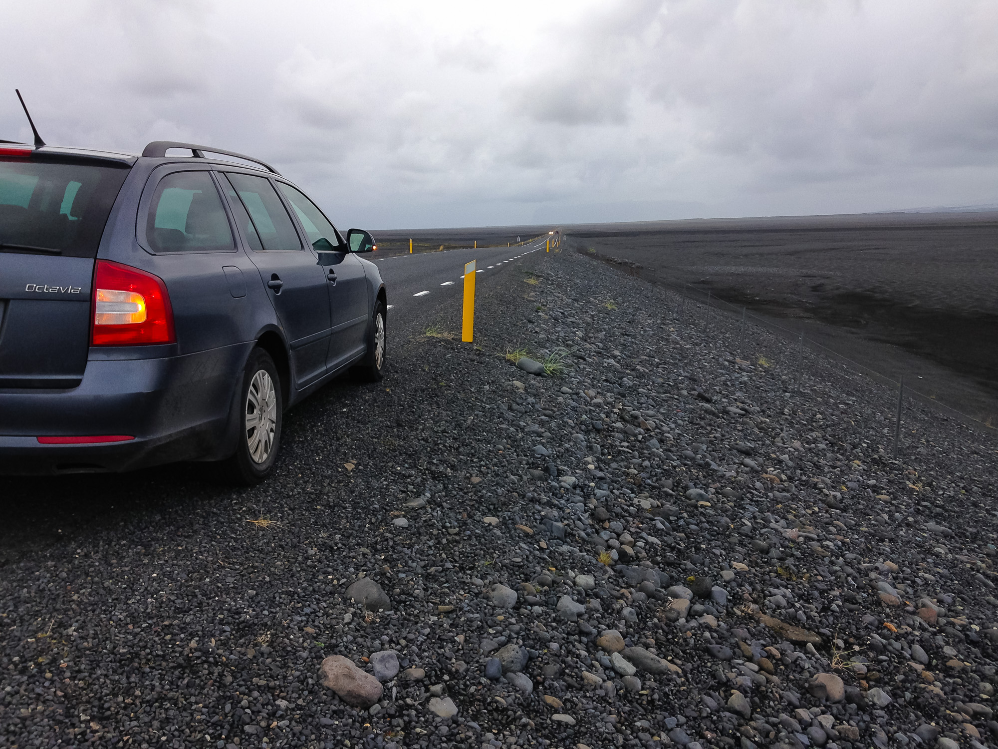
The car we were given was a Skoda Octavia, a brand I had never even heard of. The car resembled a blend between a Volvo and Subaru Forrester and had tons of trunk space for our bags and camping gear. This was a great vehicle for the trip, although next time when I go, I'll definitely want a 4x4 so I can explore the interior of the island.

There's a saying they have in Iceland: if you don't like the weather, just wait a few minutes. This definitely wasn't the case when we arrived. Our first day in Iceland was miserable cold, rainy, and windy and showed no signs of stopping. I had a sense of defeat after all the months of planning I had done. Our first two stops on our drive from Reykjavik to Akureryi at Geysir (what all the geysers in the world are named after) and Gullfoss provided us with no useful photos, and we hardly wanted to get out of the car with the biting winds and icy rain against our faces. We left Gullfoss worried that this is what the whole trip would be like. Google Maps tried leading us down an F road (unpaved "roads" that lead through the interior of the country) so we wound up having to navigate on our own back the way we came to Rt 1 (the Ring Road) on our way to our next destination, the town of Akureryi where we would be sleeping that night. The 5.5 hour drive felt like days after the long, unproductive first day.
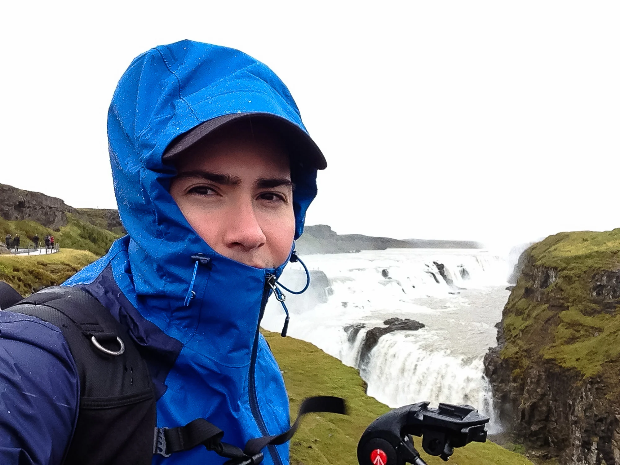
Gloomy skies, stinging winds, and icy rain was not what I was hoping for at Gullfoss (Golden Falls)

A bowl of lamb stew at Gullfoss was the highlight of day one for me, it was absolutely delicious and warmed up my spirits enough to make the drive north.
DAY TWO
When we woke up at Hotel Kea in Akureryi next morning, we were pleasantly surprised with blue skies, light cloud cover with rays of sunlight poking through. We quickly ate breakfast before hitting the road. Since we were far from the capital, we were seeing far fewer tourists on the road, in fact we were seeing fewer and fewer people on the road the further we got from the capital region. Even still we would pass a car driving the opposite direction at least 5-6 times an hour. The northern region of Iceland still has a number of hotels and other infrastructure for tourists, however with far fewer people pulling over into parking lots or off on the side of the road we actually drove straight past our first destination for the day and didn't realize it until we were about 10-15 minutes down the road. We turned around when we realized our mistake and when we arrived there was only one other car parked at Godafoss.

Hotel Kea is where we stayed our first night
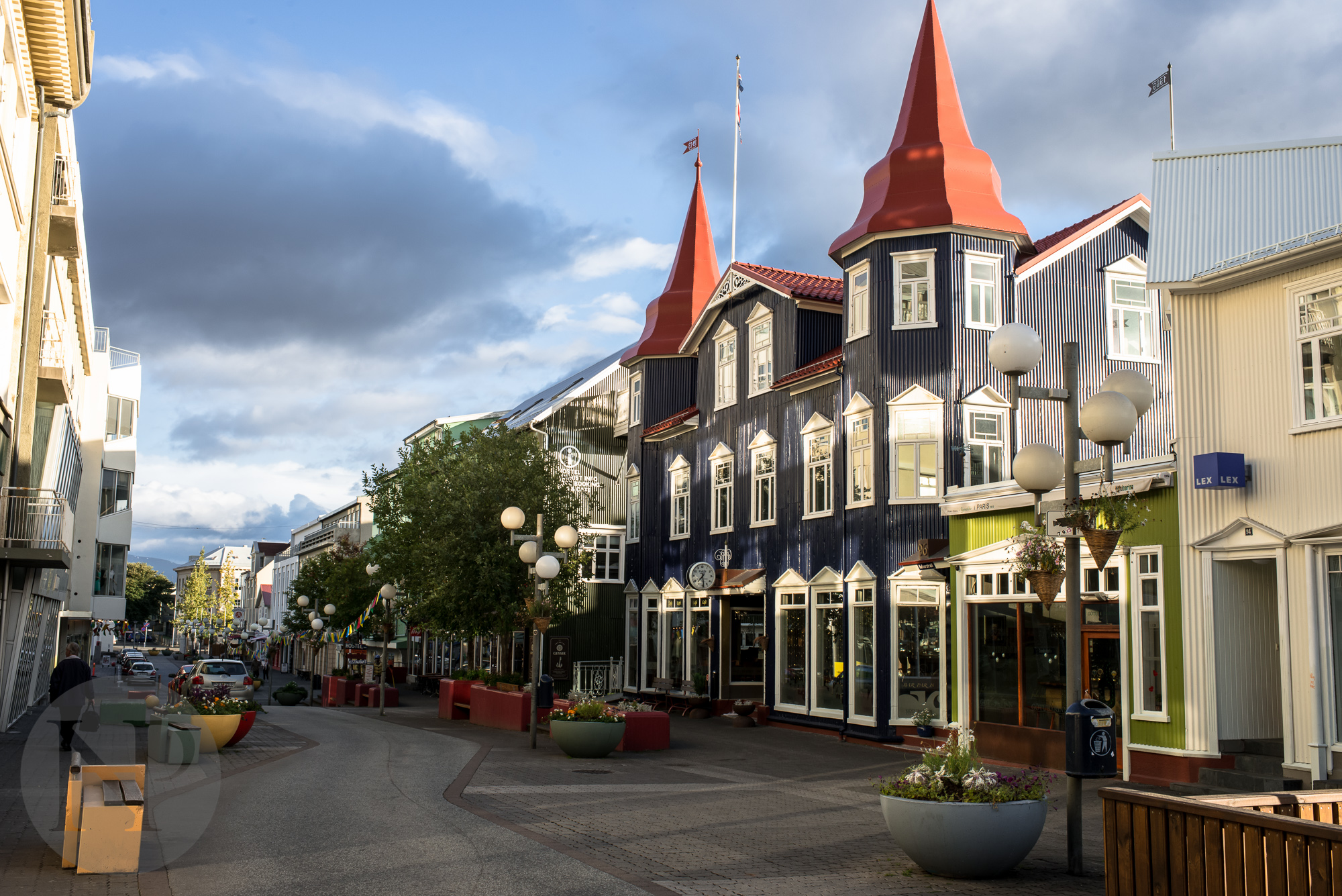
Akureryi was a neat little town but we didn't have much time to explore

A traditional Icelandic breakfast
We began a trend that morning. We'd be one of the few if any people at a destination and then when we were getting ready to leave 2-3 tour buses would show up. Those tour buses were chasing us almost the entire rest of our journey (no not the same buses but it sure felt like it)!
Once we left Godafoss we headed towards Lake Myvatn. There wasn't much to do at the lake itself but there are a few locations around that I would go check out if we had more time. We didn't want to spend time taking a dip in the lake or the nearby thermal pools, so we decided to head towards Hverfjall, a massive volcanic crater located along the east coast of Myvatn.

From a distance, it didn't seem to look like it would be a difficult hike up, however the wind was so severe that we felt like we would be blown off the top if it got much stronger. The pebbles and sand that whipped up and hit our faces stung, but we zipped our hoods tighter and kept trekking upward. The peak of Hverfjall is what I imagine an alien moon would look like. A gritty mix of black and grey sand with sharp dark grey rocks littering its surface.

Hverfjall, a volcanic crater near Lake Myvatn

A fairly straight path to the top, but brutal winds that pelted us with pebbles and sand made the journey difficult
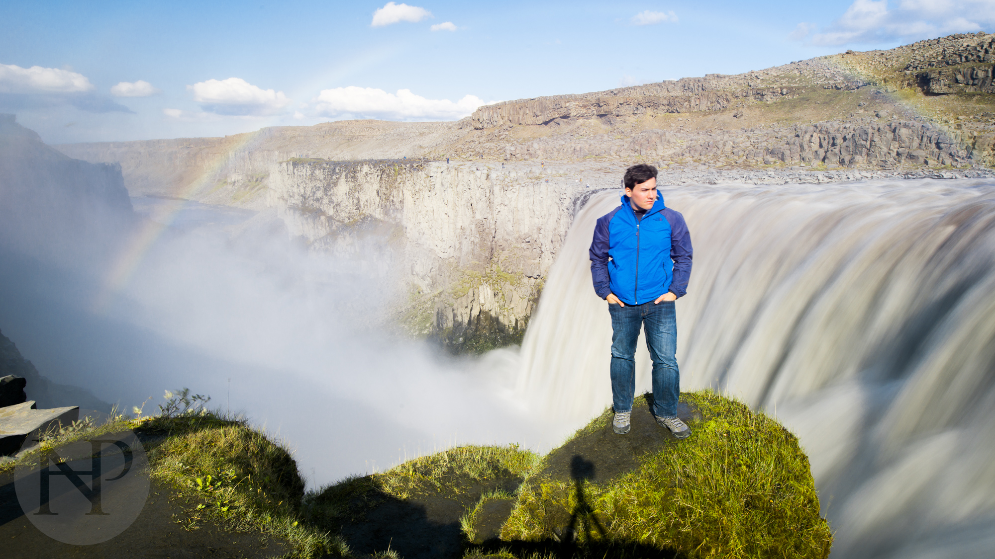
After leaving Hverfjall we traveled further east toward Dettifoss, passing by a vibrant aqua blue thermal pool being used as a source for a power plant nearby. Warning signs cautioned tourists from taking a dip in the near boiling hot waters. A little further down Route 1 reached the entrance for Selfoss and Dettifoss. The later (and much much larger) of the two is the most powerful waterfall in all of Europe, and pictures cannot capture the rush of being so close to the rushing waters. This is also where they filmed the opening scene of the movie Prometheus. According to a local we spoke to the waters were far muddier than they usually are when we were there due to the high volcanic activity in the interior of the island. We had intended to drive further north to Asbyrgi Canyon but there was a road closure due to the erupting volcanic fissures. Instead we headed 5 hours south to reach where we wanted to start the next morning.

A beautiful blue thermal pool


Our journey so far on the Ring Road was covered in smooth roads and more populated areas than I had expected, however the drive from Dettifoss to our campsite for the next night led us through the one section of the Ring Road that was unpaved gravel and dirt roads that carved through the eastern fjords and farmland. In my research I knew this section of road would preferably done with plenty of daylight as the speed limit is about half of what the rest of the Ring Road due to the sharp turns and remoteness of the area. We took it slowly keeping an eye out for reindeer, as there was signage all over warning of reindeer crossings, but never saw any. The sun was beginning to set as we passed the last of the fjords, and were once again on pavement near the small "village" of Djúpivogur.
We wanted to be as close as we could to Höfn and Vesturhorn Mountain for sunrise the next morning, and decided to press on to find a suitable place to spend the night. Campgrounds are sparse in that area of the country as tourists tend to stick to the north, south and west of Iceland. We were still passing a number of cars on the road, but they were mostly local farmers, towing supplies to and from their homes although we saw a trio of people on bicycles with camping gear strapped to their back as well, which was quite a surprise in that area of the country. Much of the ground in the south east corner of the country is covered in hard rock or soft ground peppered with pebbles, but we were able to find a great spot to camp along a small lake just outside a large farm next to Stokkesnes, a former WWII British military facility, which has been converted into a NATO radar station. We set up camp for the night on a short grassy plateau just in the knick of time before some rain started to fall outside, a few noisy sheep blurting out nearby at the farm across the water.

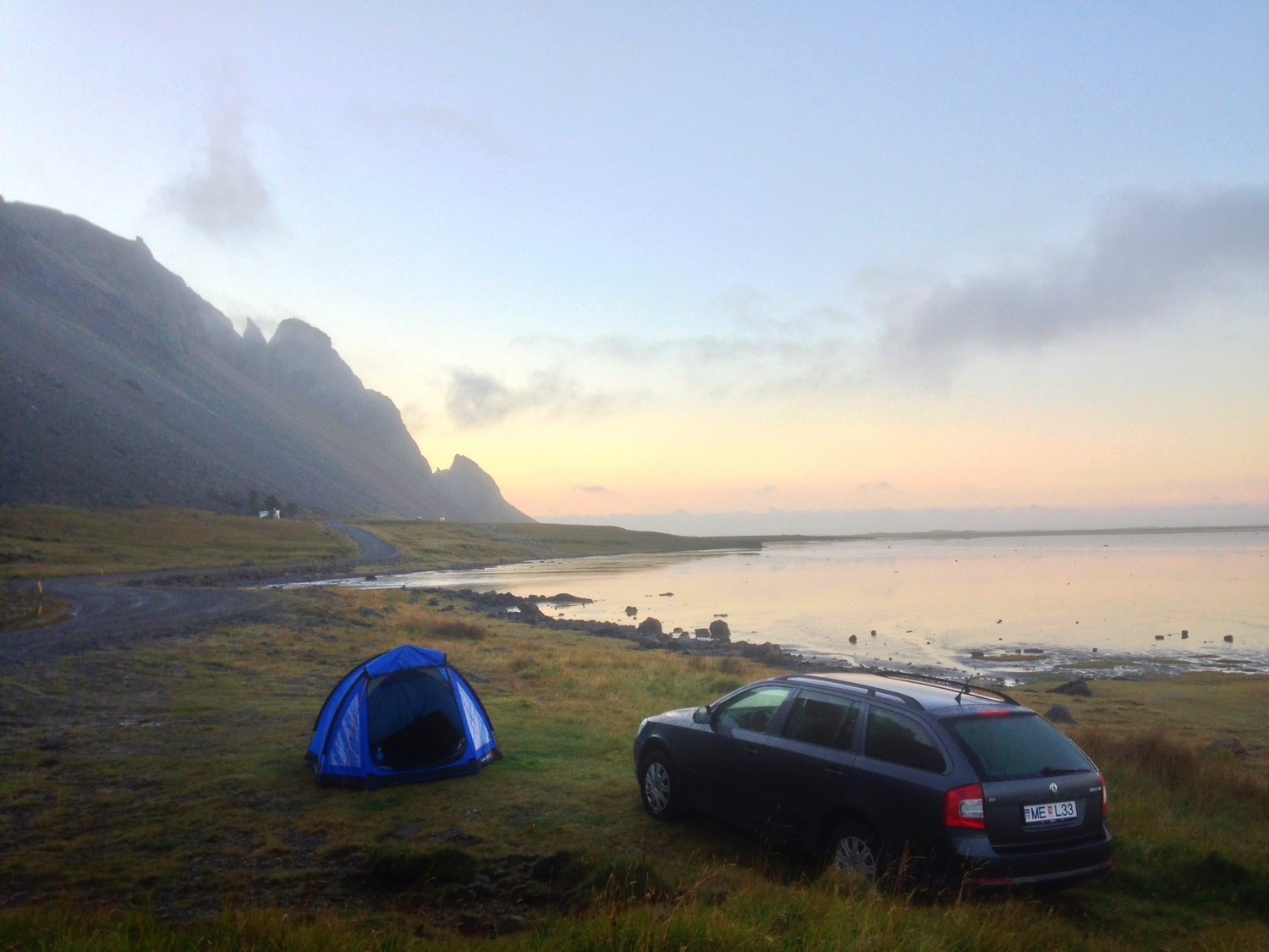
Such a beautiful view in the morning along the lake. The other shore housed one of the larger farms we saw on the trip which took up most of the peninsula

The Viking Cafe along the base of Vesturhorn Mountain
DAY THREE
When we woke in the morning, there was just the right amount of cloud cover for some killer sunrise photos. We packed up our camping gear and headed down the road about a half mile to the Viking Cafe, where a few RV's of other eager photographers had slept the night before waiting for sunrise. The owner of the cafe also owns the land between the mountain and Stokkensnes and charges a $5 toll for hiking out to the black sand beach, well worth it if you ask me. The rolling dunes covered in the vibrant yellow and green grasses provided such a cool contrast. When we first arrived the tides were so high they almost came up to the road, over the course of the next two hours, the waters receded far down the beach nearly a quarter mile.


I love this Benro tripod, it's so light yet amazingly sturdy. It folds down small enough to fit in a carry-on too! It's the perfect travel tripod.


Once we left Vesturhorn Mountain behind, we headed west to the Jökulsarlon Floating Icebergs, which are chunks of ice that break off one of the larger glaciers in the country and then wash outwards to sea. To the naked eye, it's difficult to see the movement of the larger pieces, but if you get a chance to see the video I posted you'll see how they all shift back and forth with the changing currents. The water was so blue and milky and even though much of the ice was stark white, you could see striations of black and aqua blue from the various minerals embedded into the ice. There is a small inlet that lets the icebergs escape out into the ocean, most of which is washed back unto shore. It was incredible to see these large chunks of white/blue ice resting on a black sand beach.


We continued further down Route 1 towards our destination for the night, but made one last stop before arriving at Vīk at Svartifoss, also known as the Black Waterfall. This surreal view of dark basalt tubes covered in lush green plants and moss is stunning to see in person. It began to rain shortly after we arrived at the end of the hike, although in true Icelandic fashion, we waited a few minutes and the sun punched a hole in the clouds long enough for us to get a few photos before getting back on the road.


My Think Tank Photo Shape Shifter is one of my favorite bags, especially for travel. It's been with me to three different continents and never lets me down. It's the perfect size to carry all my photo gear and still have room for other essential supplies for a hike.

The view out towards the ocean from the hike to the Svartifoss
How utterly diverse and immediate the change in the landscape can be is just astounding. In several areas around the country we would be driving aside of lush green fields and then suddenly we'd be surrounded by endless seas of black sand and rock. Other places you'd pass by farmland populated by huge groups of sheep (always group in three's for some reason...seriously we never saw sheep that weren't in packs of three) and then be driving through areas covered in mossy pumice stones. We saw more of this diversity in the west and south, but even in the north, the landscapes were so varied as to make you feel like the ground couldn't make it's mind up what it should be like.
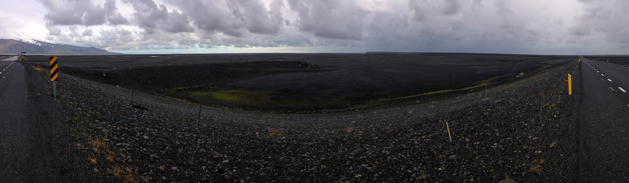
The black seas of sand and rock went on for miles
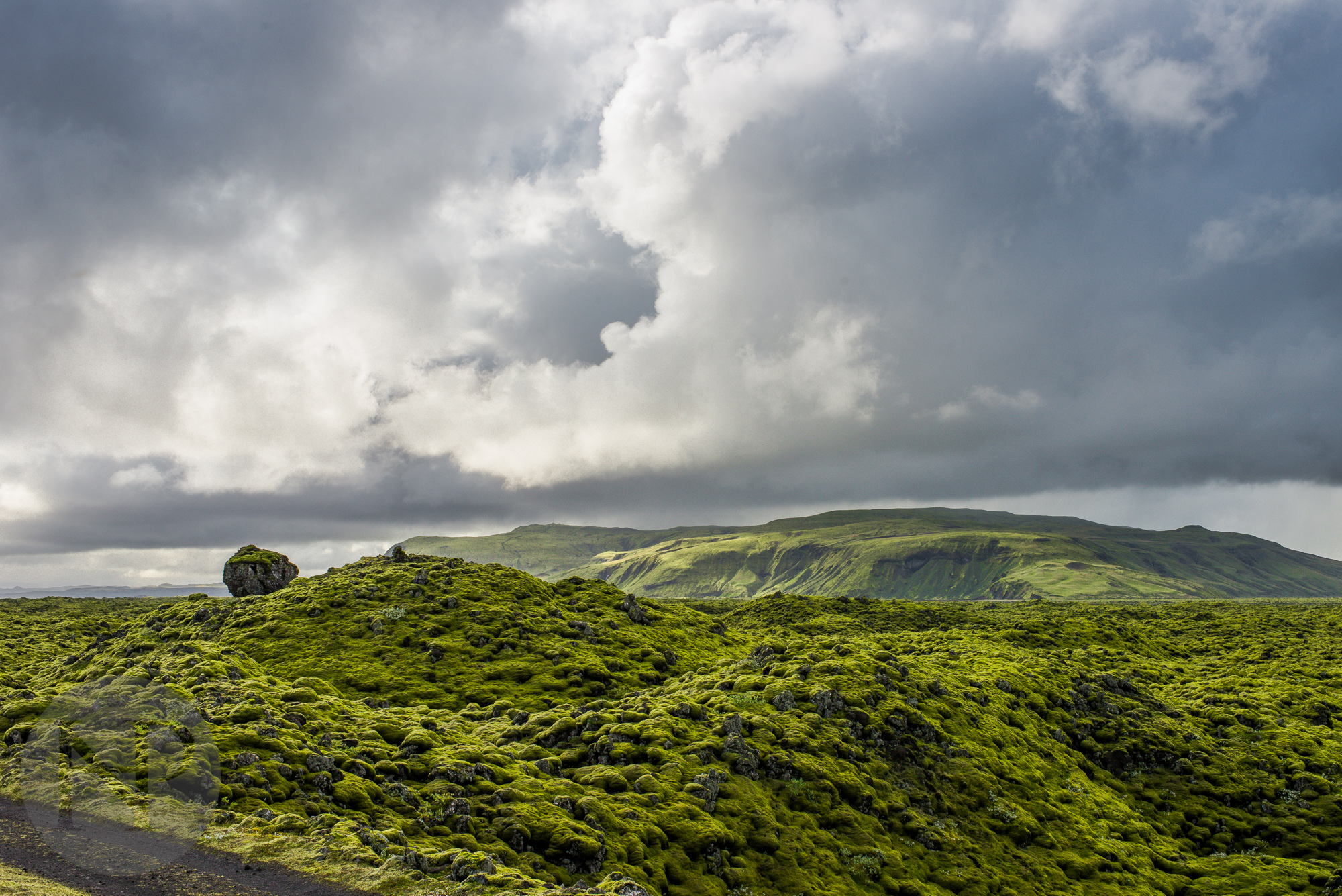
Moss covered mounds of volcanic rock
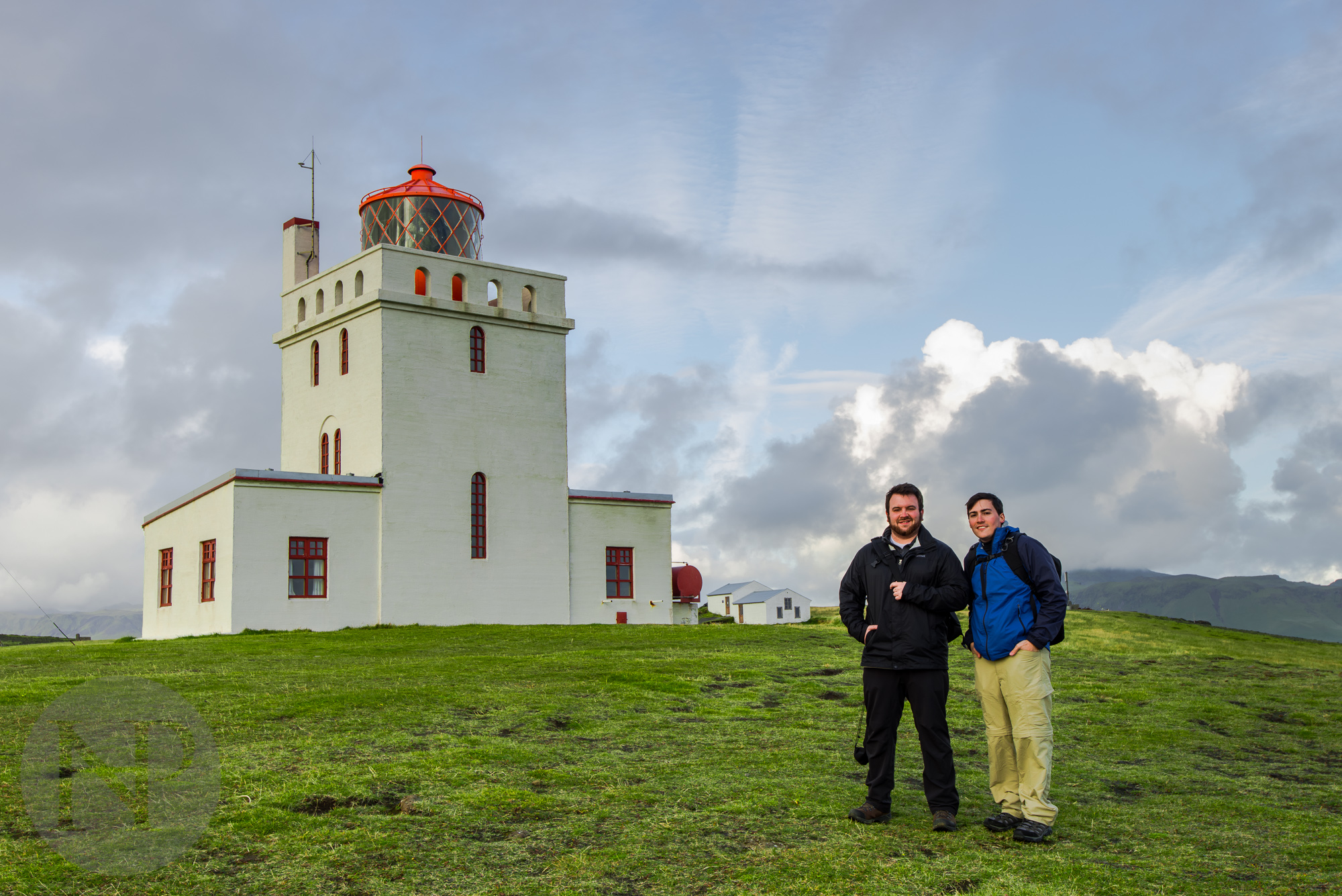
We arrived in Vīk a few hours before sunset, so after checking into Hotel Edda we drove out to Dyrhòlaey to photograph the cliffs and the lighthouse. This area is normally the home to hundreds of thousands of puffins, however as we learned from the locals, the puffins left a few weeks before our arrival to spend their winter "at sea". We heard this from several people, although no one seemed to be able to explain where the puffins actually go or if they actually just sit in the ocean until spring.
In my research I had seen photos of Dyrhòlaey but it was so much more massive than I expected. In the photo below you'll see these tiny specks walking along the cliffs...those are people. It's a kind of scale you have to see to believe. We hiked all the way to the furthest point of the cliffs before settling in for sunset. The rain from the night before and earlier during the day had left these rich fluffy clouds in the sky which made the whole scene just so magical against the rough crashing waters along the shoreline below.
After the sun had dipped into the horizon, we headed back into town for a delicious dinner and some beer after a very successful and exciting day.

Cliffs at Dyrholaey, those tiny specks are people!


DAY FOUR
Our alarms began blaring at 5AM as they had the previous two days, and we were on the road by 5:20, which was just in time to get back to the beach near Dryholaey for sunrise. The morning mists over the ocean were slowly rolling across the black beach as the sun began to creep over the distant cliffs. The large rock formation sits at the end of the beach, waters trickling out to sea on both sides. After sunrise, we headed back to the hotel to check out and grab the rest of our bags, and have some breakfast of smoked fish and bread. Once we were refueled we headed to the beach one last time, however this time to see the basalt stacks and a cave on the other end closer to the town of Vīk.

Sunrise over the beach

Earlier in the morning when were photographing the sunrise, I couldn't tell that the beach was not made up of the same loose volcanic sand that the shore along Vesturhorn Mountain was made of. Instead it was a collection of pebbles, shrinking in size the closer you got to the shoreline. The sea acts as a rock tumbler, tossing the small pebbles against the larger pebbles along the beach until they're all worn and smooth. You can see in the photo below, small black pebbles being tossed up by the crash of the surf on the shore.


A beach made of small smooth pebbles

Small pebbles crashing against the shoreline
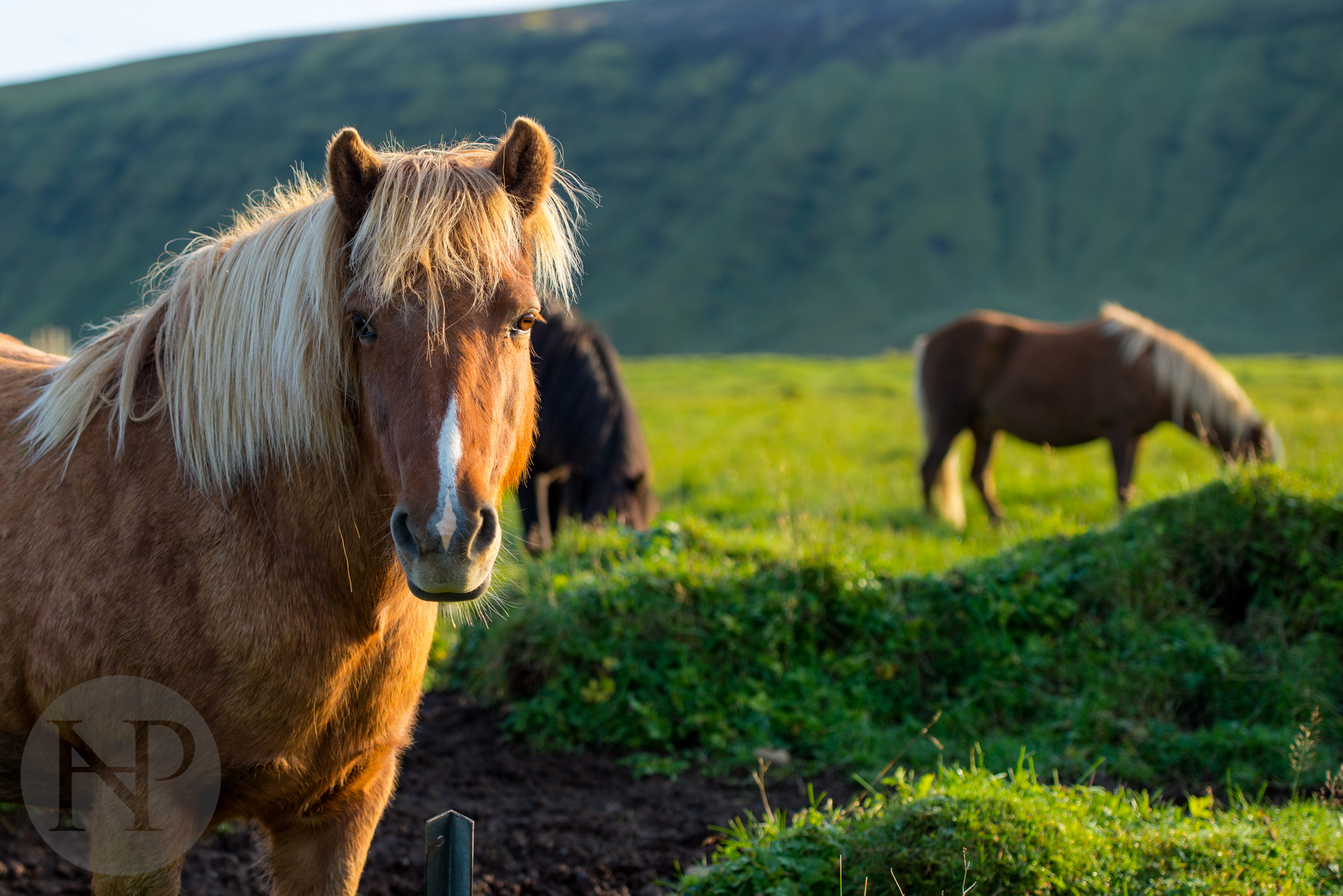
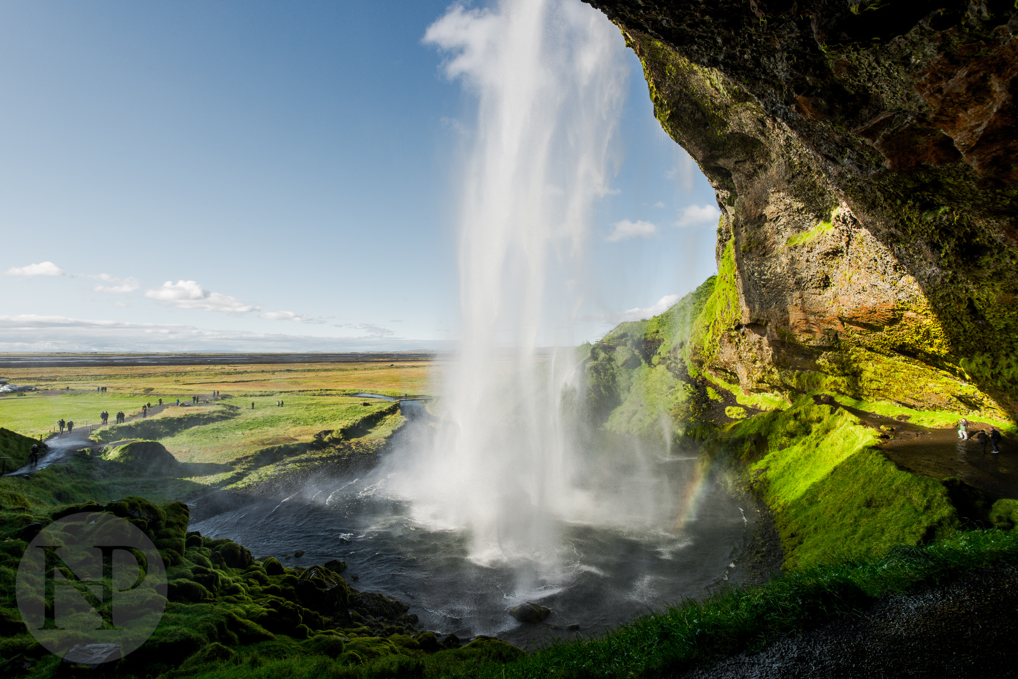
It was almost noon by the time we decided to leave Vīk, passing by a horse farm and more rolling green hills on our way to Skogafoss and Seljalandfoss, the last two stops of our journey before returning to Reykjavik. The parking lot of Seljalandfoss was easily the most packed we have seen since leaving Jökulsarlon the previous day, and understandably so. This beautiful waterfall cascades over a cavernous space you can walk behind, offering a stunning misty view of the nearby landscape. Near the top of the falls, a large number of gulls were nesting, and several flew out to greet my Phantom 2 as I recorded some sweeping footage of the falls. After lunching on some salmon, red pepper and landbread sandwiches at the little visitor booth/ souvenir shop, we got back in the car and headed back to the capital region.

The town of Vīk


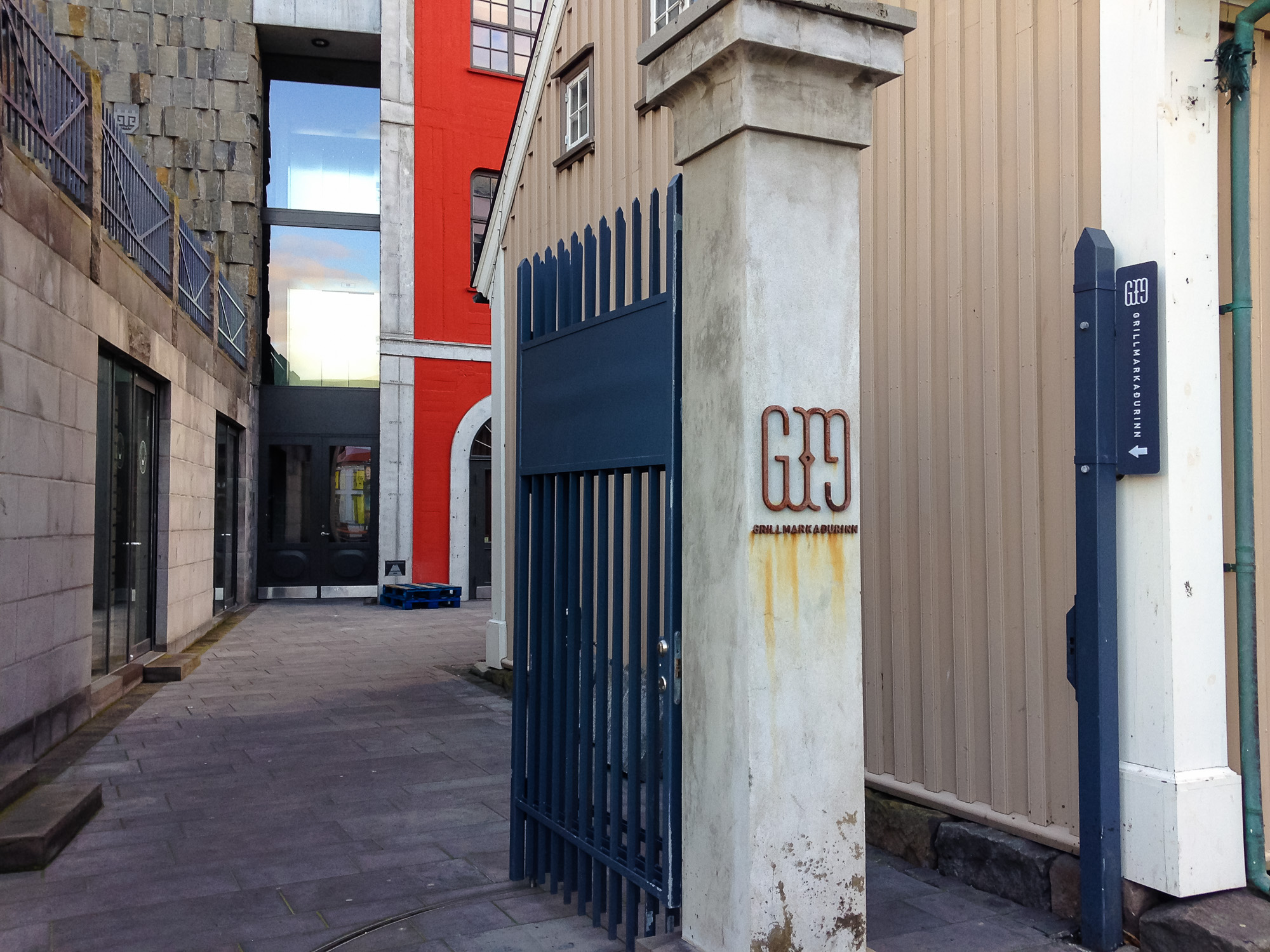
We arrived in Reykjavik a little after 6pm, and after decompressing and relaxing in the hotel for a short time, we headed out to find dinner. In my research I had heard of a restaurant called Grillmarkindurinn and the few locals we asked said it was the best one in town, so we looked up the location online and headed out to eat. The entrance was hidden off the street, in fact we actually walked right by it on our first pass by. We stopped in a store to ask if we had the right address, and they directed us down the alley. A man was outside smoking as we walked up, unsure if we were at the right place due to the limited signage. He said in a thick German accent "you've got to eat here, I just had the tasting menu and it was not only a great meal, it was the best meal. This isn't just a restaurant, it's not just good, it's one of the best I've ever been to". Bryant and I looked at each other, thinking the guy was just drunk, crazy or maybe a little bit of both, but we went inside, and were blown away...the crazy guy was right. It was one of the coolest restaurants/bars I've been too, with modern, yet rustic decor, and an atmosphere that was unlike any place I've ever eaten before.
If you ever go to Reykjavik...eat at Grillmarkindurinn. You'll thank me later. I'd tell you more but I don't want to spoil the surprises.


DAY FIVE
Our final morning in Iceland was spent recovering from the food coma from the night before and wandering around the city center region of the city. For a Friday morning in the nation's capitol it was surprising to see the city streets so empty. We browsed a few shops looking for souvenirs before grabbing lunch at one of the more famous pylsur (hot dog) stands, that has been in business for 70 years! After browsing through a few more shops we went into Hallgrimskirche, the largest church and tallest building in the capitol of Reykjavik. You can take an elevator to the top and look out over the roof tops of the entire city! After taking a few photos, we headed back to the car and made our way back to the airport at Keflavik.


Iceland loves their pylsur! (hotdogs)

Hallgrimskirche


In Closing:
I can't wait to go back. Iceland was one of the most beautiful places I've ever been to in my life, and there was so much left to see. 5 days was just enough to scratch the surface! I had dreamed of going for years and the trip exceeded my every expectation and dream. From the stunning scenery and natural formations to the wonderfully nice people, it's truly an amazing place.

One of my favorites from the trip. Sunrise at Vesturhorn Mountain